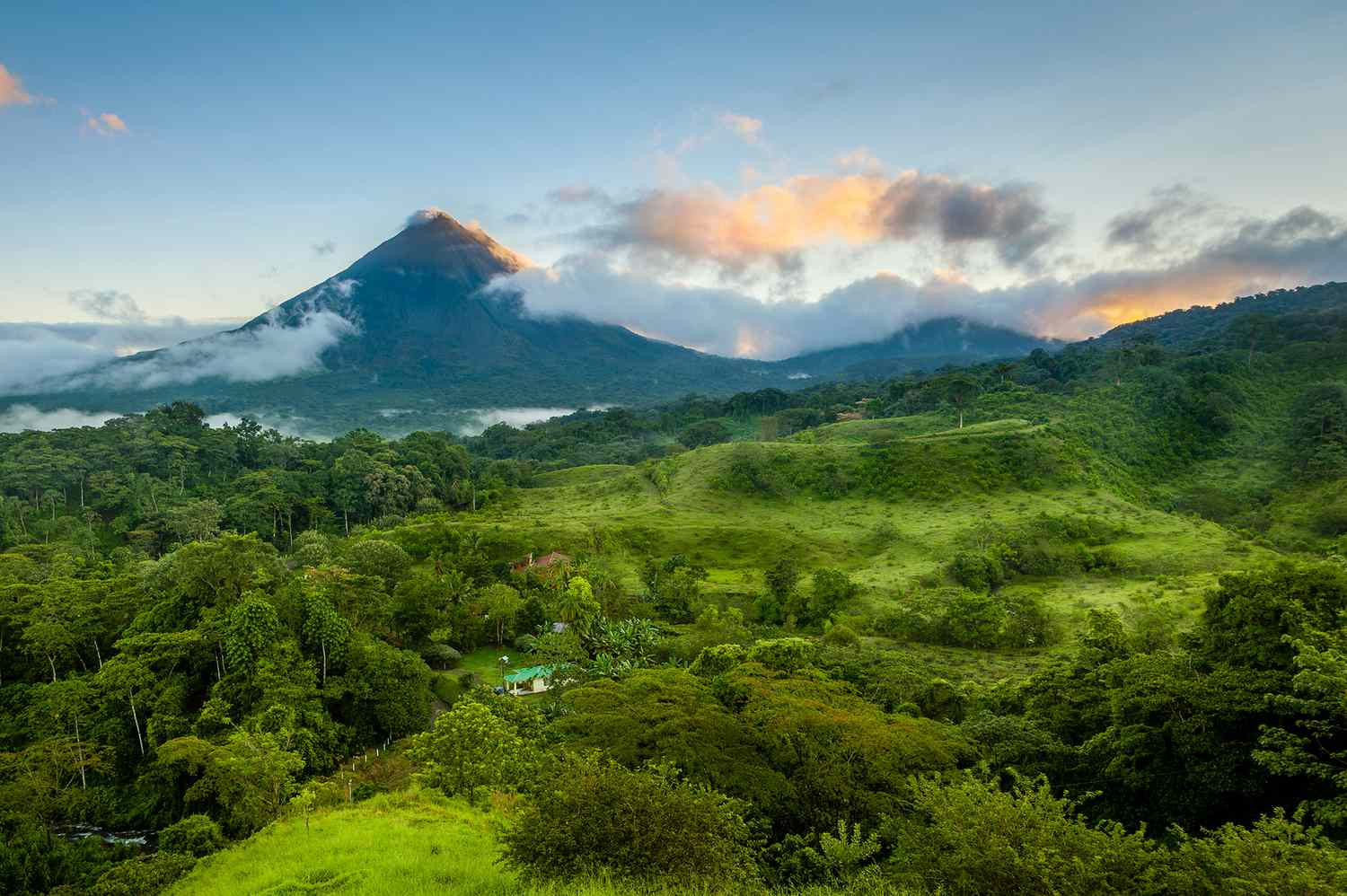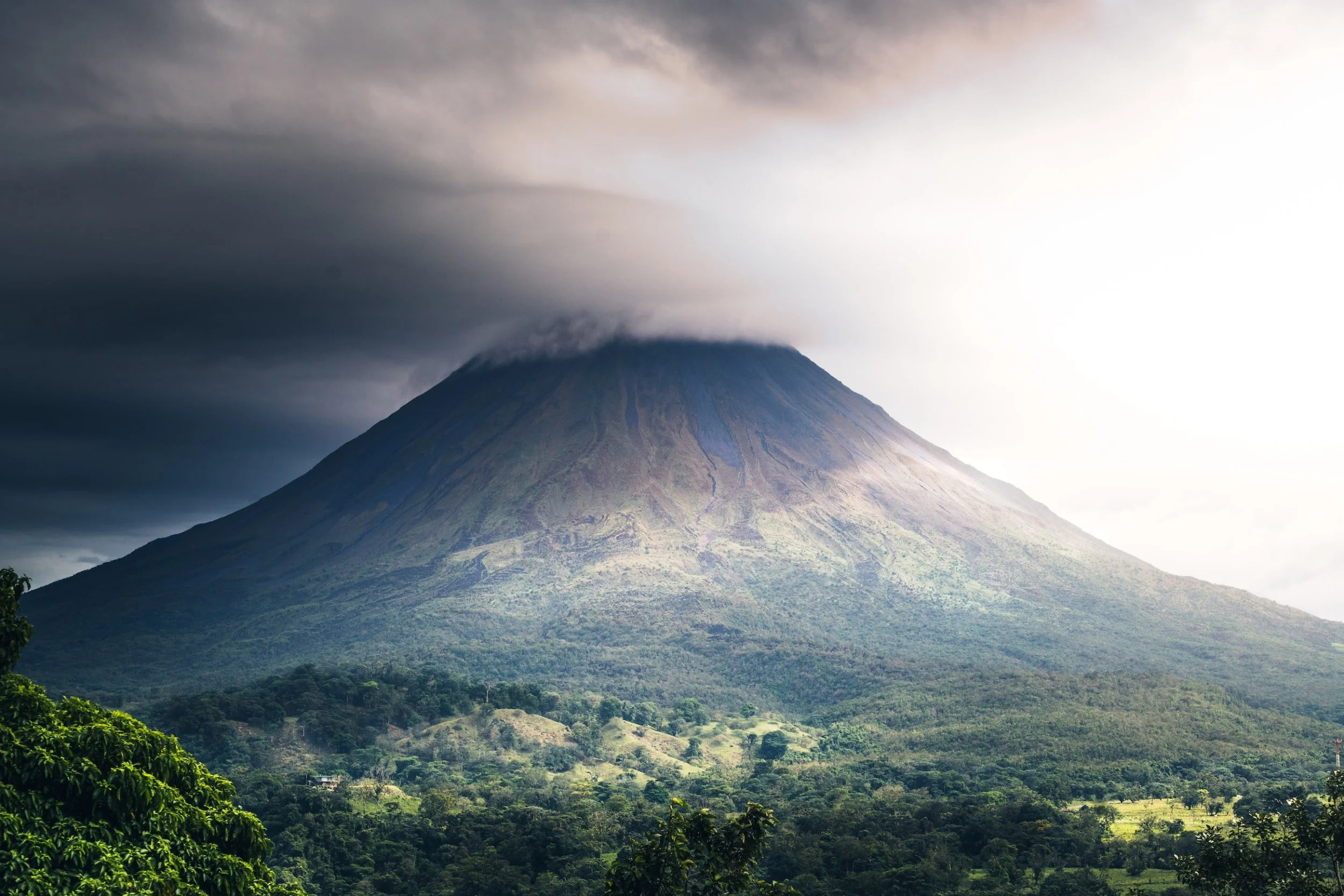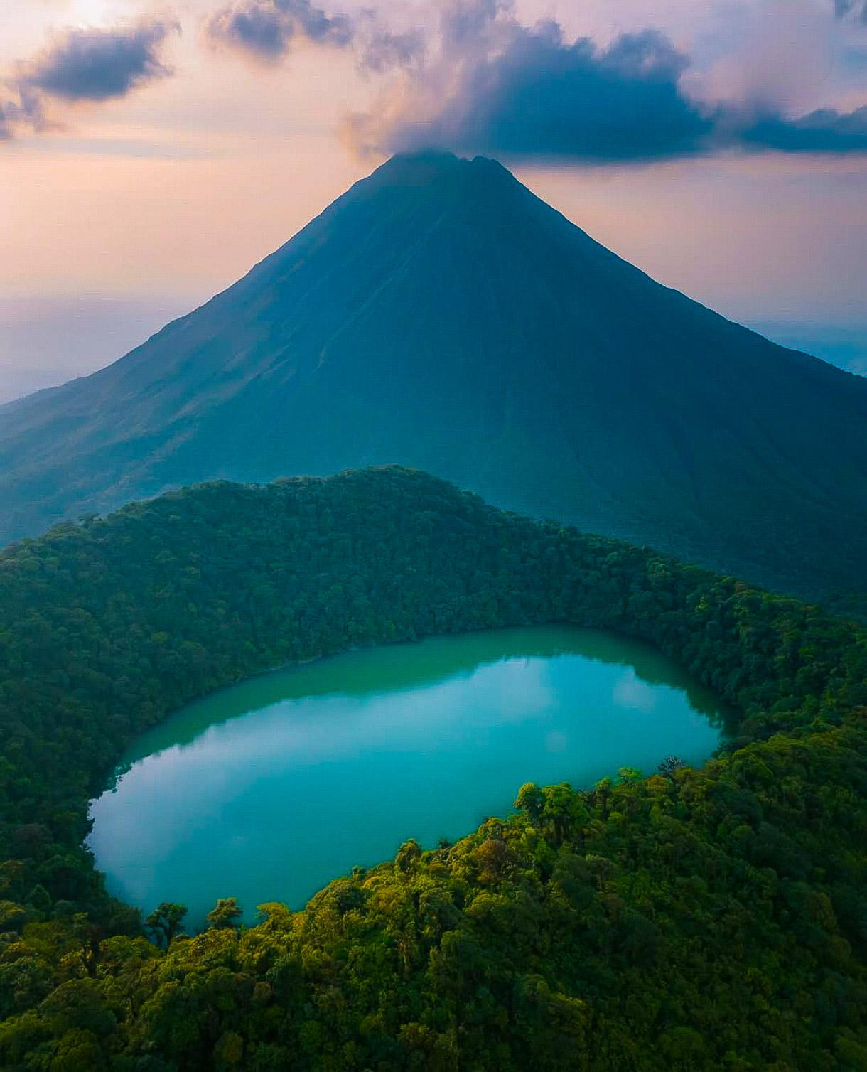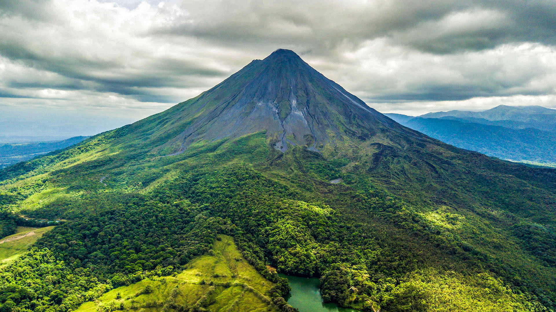
Arenal Volcano rises 1,633 meters above the Costa Rican rainforest in Alajuela Province, roughly 90 kilometers northwest of San José, its near-perfect symmetrical cone long serving as one of the country's most recognizable natural landmarks. The volcano's summit crater measures 140 meters across, and its remarkably regular, textbook stratovolcano shape, built up from alternating layers of lava and volcanic ash over repeated eruptive cycles, has made Arenal a frequently used illustration of classic conical volcano form in geology textbooks and educational materials well beyond Costa Rica itself. For centuries before its most famous eruption, Arenal sat quietly enough that surrounding communities had little sense of the volcano's true nature, its slopes covered in dense tropical forest that gave few visible signs of the geological forces building beneath the surface.
That changed abruptly on July 29, 1968, when Arenal erupted violently after what geologists believe was a long dormancy stretching back centuries, an eruption powerful enough to affect more than 230 square kilometers of surrounding land and kill 87 people, burying three small villages, Tabacón, Pueblo Nuevo, and San Luis, beneath pyroclastic flows and ash. The suddenness and destructive force of the 1968 eruption transformed local understanding of the mountain overnight, turning what had been considered simply a large forested hill into an actively dangerous volcano, and the disaster prompted the eventual evacuation and permanent abandonment of the immediate hazard zone around the cone. In the aftermath, Costa Rican authorities established exclusion areas and, over subsequent decades, built the broader tourism and safety infrastructure that now governs how visitors are permitted to approach the volcano, a direct legacy of lessons learned from a disaster that caught the surrounding population almost entirely by surprise.
Following the 1968 eruption, Arenal entered a period of remarkably sustained activity, erupting more or less continuously for the next 42 years, a duration that ranks among the longest volcanic eruptions recorded anywhere on Earth since 1750, placing it tenth on that list globally. Throughout this period, the volcano regularly produced visible lava flows, incandescent rock falls, and ash emissions, at times creating a genuine nighttime spectacle of glowing lava visible from surrounding hotels and viewpoints, a phenomenon that became a significant draw for the tourism industry that grew up around the base of the volcano during these decades of activity. This long eruptive phase finally ended in 2010, when Arenal fell silent and has remained dormant since, a transition that fundamentally changed the visitor experience at the site, shifting the appeal from the dramatic possibility of watching active lava flows to a quieter appreciation of the volcano's form, surrounding rainforest, and geothermal features that persist even without visible eruptive activity.
Even in its current dormant state, Arenal's underlying geothermal system remains active, most visibly in the network of natural hot springs that dot the base of the volcano and have themselves become a major independent tourism draw, with resorts built around naturally heated mineral pools fed by groundwater warmed as it circulates near the volcano's still-hot interior rock. In September 2013, minor steam plumes and localized tremors briefly raised questions about renewed activity, though no eruption followed, a reminder that dormant status does not mean the volcanic system has gone fully quiet, only that surface eruptions have paused for the time being. Volcanologists continue to monitor Arenal alongside other active and potentially active volcanoes in Costa Rica's chain of the Central American Volcanic Arc, part of the broader tectonic activity produced by the subduction of the Cocos Plate beneath the Caribbean Plate that also accounts for the country's frequent earthquakes and its unusually high concentration of volcanic peaks for such a small national territory.
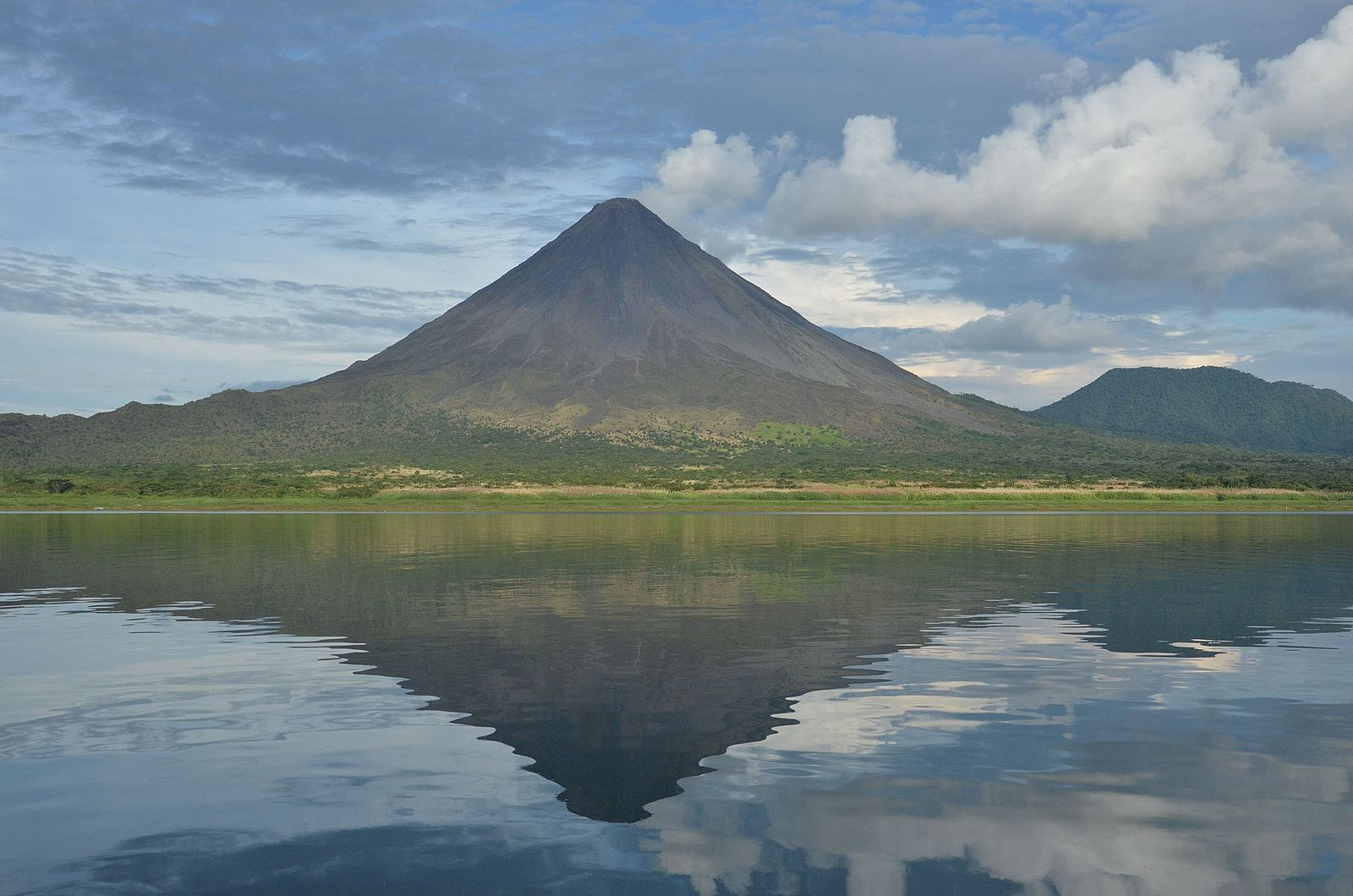
Arenal Volcano National Park protects the volcano and a substantial surrounding area of primary and secondary rainforest, offering hiking trails across old lava fields from the 1968 eruption and earlier flows, where visitors can walk across solidified black rock now being slowly recolonized by pioneer plant species in a visible, ongoing example of ecological succession following volcanic disturbance. The park's forest supports a rich array of wildlife typical of Costa Rica's biodiverse lowland and premontane rainforest zones, including howler and capuchin monkeys, toucans, and a wide range of smaller birds and reptiles, giving visitors a broader rainforest wildlife experience alongside the volcanic geology that draws most people to the area in the first place. Arenal Lake, an artificial reservoir created by a hydroelectric dam project on the volcano's northern side, adds a further recreational dimension to the area, with the lake used for windsurfing, kitesurfing, and boat tours that offer distant views of the cone reflected in the water on clear days.
The town of La Fortuna, roughly 15 kilometers northeast of the volcano, has grown from a small agricultural settlement into Costa Rica's primary hub for Arenal-area tourism, its economy now built substantially around the steady flow of visitors coming to see the volcano, soak in the hot springs, and access the wider Arenal region's canopy zip-lines, waterfalls, and rainforest hiking. Most visitors base themselves in or near La Fortuna, using it as a launch point for day trips into the national park, hot spring resorts scattered around the base of the volcano, and nearby attractions such as La Fortuna Waterfall, a dramatic cascade dropping into a forest pool a short drive from town. San José's Juan Santamaría International Airport serves as the main international gateway to the wider region, with the drive to La Fortuna taking roughly three hours by road, though smaller domestic flights and shuttle services also connect the capital directly to the Arenal area for visitors looking to save time.
Costa Rica's Arenal region sits in a genuinely wet tropical climate, and cloud cover frequently obscures the volcano's summit regardless of season, a fact that surprises visitors expecting guaranteed clear views of the iconic cone; locals often note that patience across a multi-day stay improves the odds of a clear sighting far more than choosing any particular month. That said, the dry season from December through April generally offers the best overall chance of clear skies and comfortable hiking conditions, while the wetter months from May through November bring more frequent rain and cloud but also a notably lusher, greener rainforest landscape, along with typically lower accommodation prices and thinner crowds at the area's hot springs and trails.
Arenal's transformation from an obscure forested hill into one of Central America's best-known volcanic tourism destinations has been studied as something of a case example in how a natural disaster can, over subsequent decades, reshape a local economy around the very hazard that caused it. The infrastructure built up around La Fortuna, including hot spring resorts, guided lava-field hiking during the active decades, and now a broader ecotourism industry covering canopy tours, birdwatching, and rainforest lodges, developed almost entirely in response to the volcano's post-1968 fame, turning what had been a sparsely visited agricultural region into one of Costa Rica's most economically important tourism zones. This shift mirrors a pattern seen at other volcanic tourism sites worldwide, where the same geological forces capable of causing destruction also generate long-term visitor interest, though Arenal's now-dormant status means the area's future tourism appeal increasingly rests on its rainforest ecology, hot springs, and scenic cone rather than the direct spectacle of visible eruption that originally put the region on the map.
No reviews yet. Be the first to share your experience!
Share your experience and help other travelers