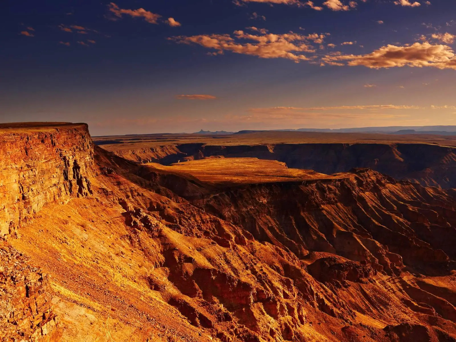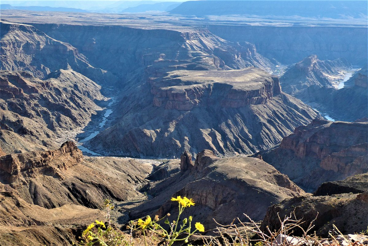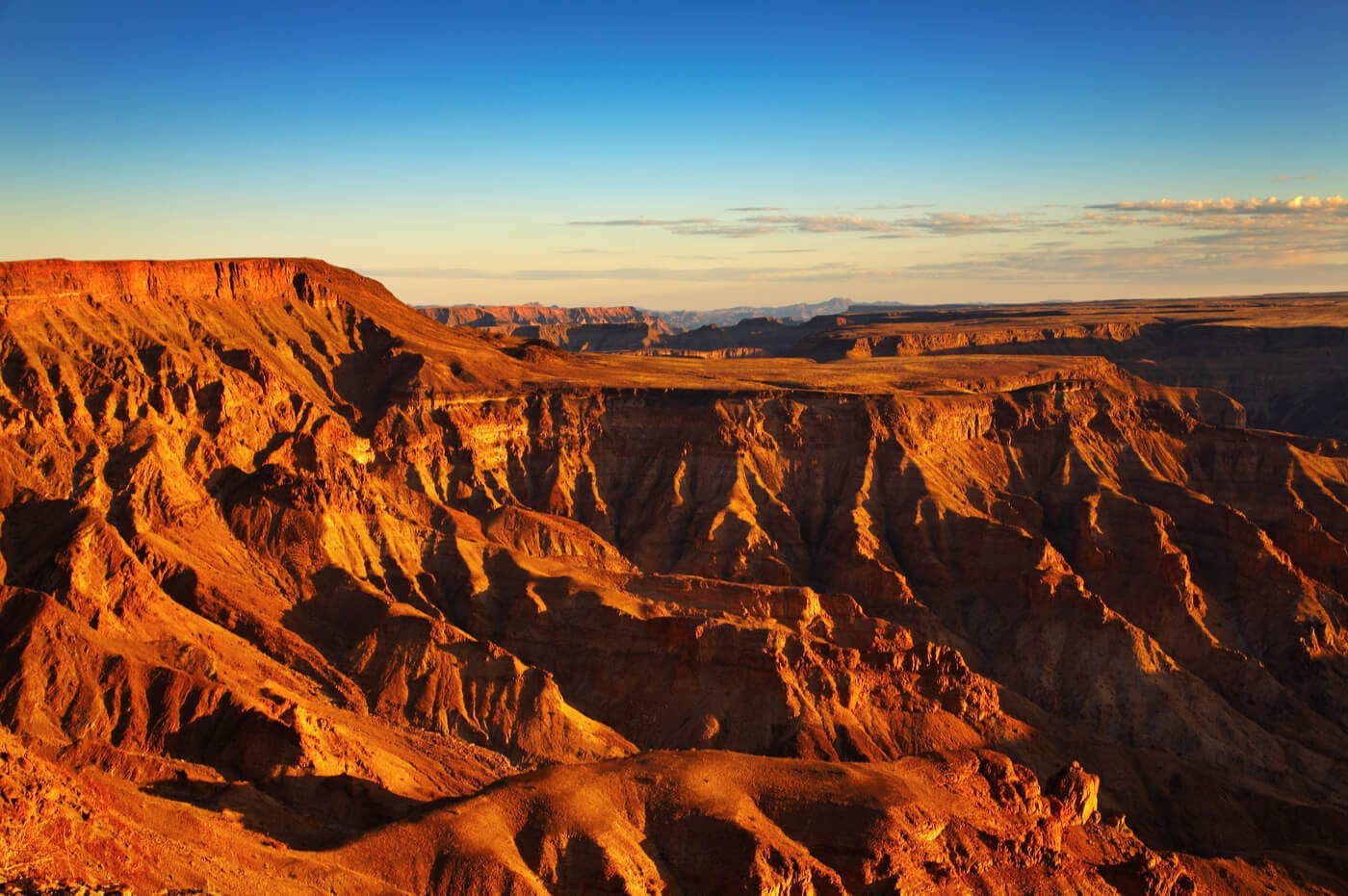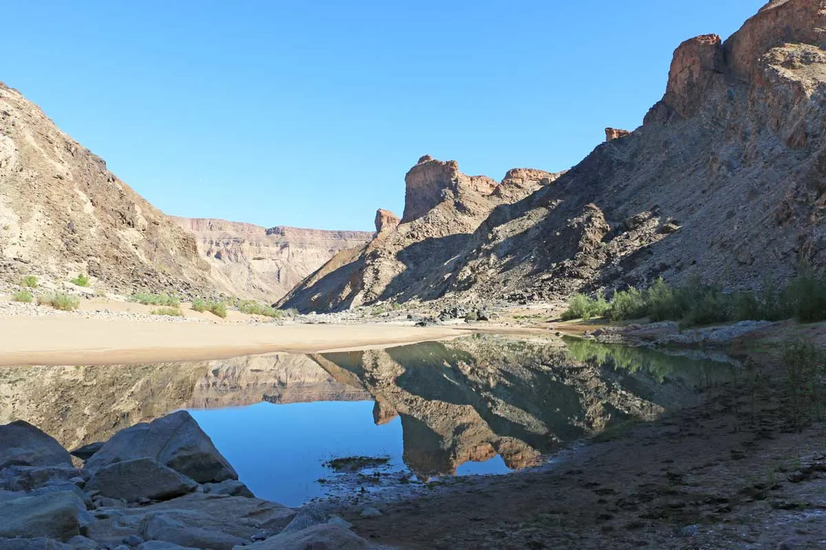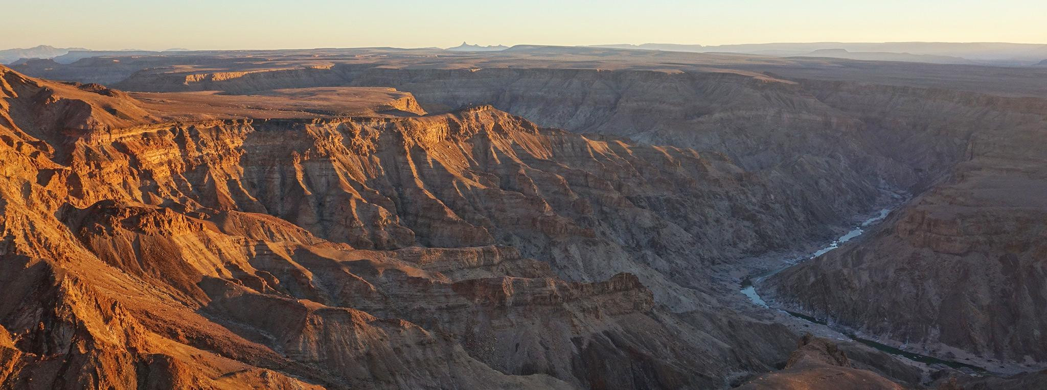
Fish River Canyon cuts through the arid landscape of southern Namibia, a vast ravine spanning roughly 5,900 square kilometers that stands as the largest canyon in Africa and, by some measures cited in Namibian tourism promotion, the second largest canyon on Earth after the Grand Canyon, though direct comparisons between canyons measured by different criteria worldwide are inherently somewhat imprecise. The canyon stretches approximately 160 kilometers in length, reaches up to 27 kilometers across at its widest points, and plunges nearly 550 meters at its deepest, carved by the Fish River, Namibia's longest interior river, as it winds through a landscape so dry and sparsely vegetated that the canyon's scale becomes almost more apparent from its rim than from within, where the sheer expanse of rock and open space can be difficult to fully register at ground level.
Fish River Canyon's geological history unfolds across an almost unimaginably long timescale even by the standards of major canyon systems worldwide, beginning with the formation of a graben, a down-dropped block of the Earth's crust bounded by parallel faults, roughly 650 million years ago. Glaciation further deepened this initial structure around 300 million years ago, as ice sheets during an ancient glacial period ground across the region and widened the developing depression well before the canyon took on anything resembling its current appearance. The most recent major chapter in the canyon's formation began around 60 million years ago, when continental drift and associated uplift raised the African continent, giving the Fish River the elevation gradient and erosive energy needed to carve its final, dramatic lower canyon through the hard metamorphic rock that forms much of the gorge's most visually striking sections, a combination of graben formation, glacial widening, and river incision that together produced one of the more geologically complex large canyon systems anywhere in the world.
The Fish River itself flows intermittently through much of the year, reduced in the dry season to isolated pools connected by dry or nearly dry riverbed sections, before swelling dramatically during the region's brief rainy season, when seasonal flooding can transform the canyon floor from a parched, rocky landscape into a genuinely flowing river within a matter of days. This intermittent flow pattern reflects the broader arid climate of southern Namibia, part of the Nama Karoo and Succulent Karoo biomes that dominate much of the country's interior, and it shapes both the canyon's ecology, which has adapted to long dry stretches punctuated by occasional dramatic flooding, and the practical planning required for anyone attempting to hike the canyon floor, since the hiking season is deliberately restricted to months when flash flood risk is lowest and pools along the route remain reliable sources of drinking water for trekkers.
An 88-kilometer hiking trail descends steeply from the Hobas viewpoint into the canyon and follows the Fish River's course south to the resort settlement of Ai-Ais, a route that typically takes around five days to complete and ranks among southern Africa's most demanding and rewarding multi-day wilderness hikes. The trail requires a permit, with groups restricted to between three and thirty members, all participants required to be at least twelve years old and to carry a medical fitness certificate confirming they are healthy enough for the physically demanding, largely unsupported trek across rough, rocky terrain with no rescue infrastructure along most of the route. Namibian park authorities restrict the hiking season to run from May 1 through September 15 each year, a window chosen specifically to avoid both the extreme heat of the southern African summer and the flash flood risk that makes the canyon floor genuinely dangerous during the rainy season, when water levels can rise suddenly and without adequate warning for hikers already committed to the trail.
The Ai-Ais resort, marking the southern terminus of the canyon hiking trail, takes its name from a Nama phrase meaning burning water, a reference to the natural hot springs that emerge at the site and have drawn visitors for their reputed therapeutic properties long before the area was developed into a formal tourism resort with lodging and thermal pools. For hikers completing the demanding five-day trek from Hobas, the hot springs at Ai-Ais function as both a literal and symbolic endpoint, offering a genuinely welcome soak after days of strenuous walking across exposed, rocky canyon terrain in a climate that offers little natural shade or relief along most of the route. The resort also serves visitors who have not hiked the canyon at all, functioning as a standalone destination for travelers interested primarily in the hot springs and the dramatic desert scenery surrounding the canyon's southern end, without necessarily undertaking the full multi-day trek that connects it to the northern viewpoints near Hobas.
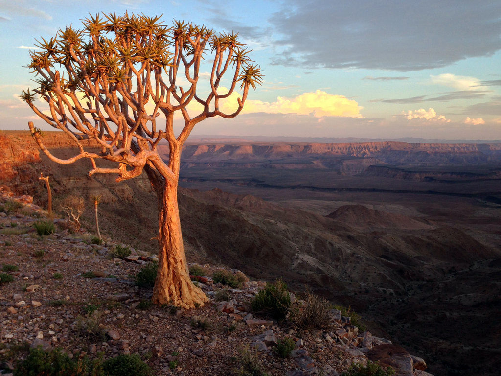
Visitors who prefer not to commit to the demanding multi-day hike can still experience Fish River Canyon's scale from a series of viewpoints along the canyon's rim near Hobas, reachable by vehicle and short walks, offering sweeping views down into the gorge without requiring the fitness, permits, and time commitment the full trail demands. These rim viewpoints, particularly popular around sunset when the low-angle light brings out the canyon's layered rock colors most vividly, represent by far the most common way most visitors actually experience Fish River Canyon, since the full trek's permit restrictions, seasonal limitations, and physical demands put the complete hiking experience out of reach for a large share of travelers who nonetheless want to see one of Namibia's most significant natural landmarks. A smaller number of shorter day-hike options exist near the rim for visitors wanting more than a viewpoint stop but less commitment than the full five-day trail south to Ai-Ais.
Fish River Canyon sits in a remote stretch of southern Namibia, and Hobas, the main trailhead and rim viewpoint area, lies roughly 70 kilometers north of Ai-Ais, with the nearest sizable town, Keetmanshoop, serving as a common overnight stop and fuel point for visitors driving in from Windhoek, Namibia's capital, a journey that typically takes the better part of a full day given the long distances and often unpaved roads characteristic of travel through much of rural Namibia. The dry season from May through September offers the most reliable conditions for both the multi-day hike and simple rim viewpoint visits, with daytime temperatures in this window ranging from a cool 5 degrees Celsius overnight to a manageable 30 degrees Celsius during the day, a considerably more comfortable range than the extreme summer heat and flash flood risk that make the canyon largely off-limits to hikers, and less appealing even for casual visitors, during the rest of the year.
Namibia's broader reputation as one of the least densely populated countries on Earth is directly visible in the experience of visiting Fish River Canyon, where the sheer emptiness of the surrounding desert landscape, largely free of towns, fences, or visible human development for long stretches around the canyon itself, adds a sense of genuine remoteness that distinguishes it from more heavily developed and visited canyon systems elsewhere in the world. This isolation has historically made the canyon a less internationally famous destination than its scale might otherwise suggest, with far fewer annual visitors than comparably sized natural wonders on other continents, though it has also helped preserve the trail experience as a genuinely rugged wilderness trek rather than one increasingly managed around high visitor volumes. For travelers willing to make the long journey through Namibia's sparsely populated south, Fish River Canyon offers a rare combination in the modern travel landscape: a natural feature of genuinely continental significance that can still, particularly outside the trail's brief permitted hiking season, be experienced in near-total solitude.
No reviews yet. Be the first to share your experience!
Share your experience and help other travelers