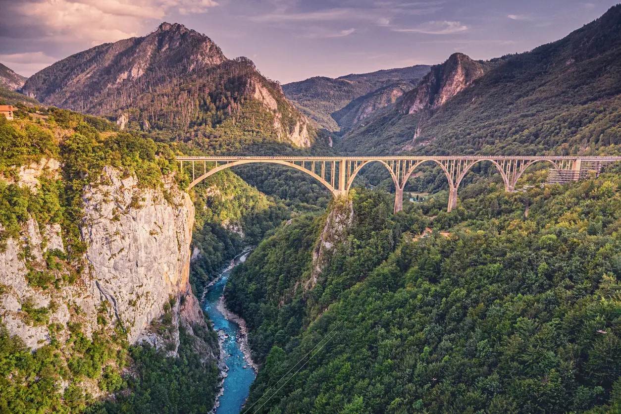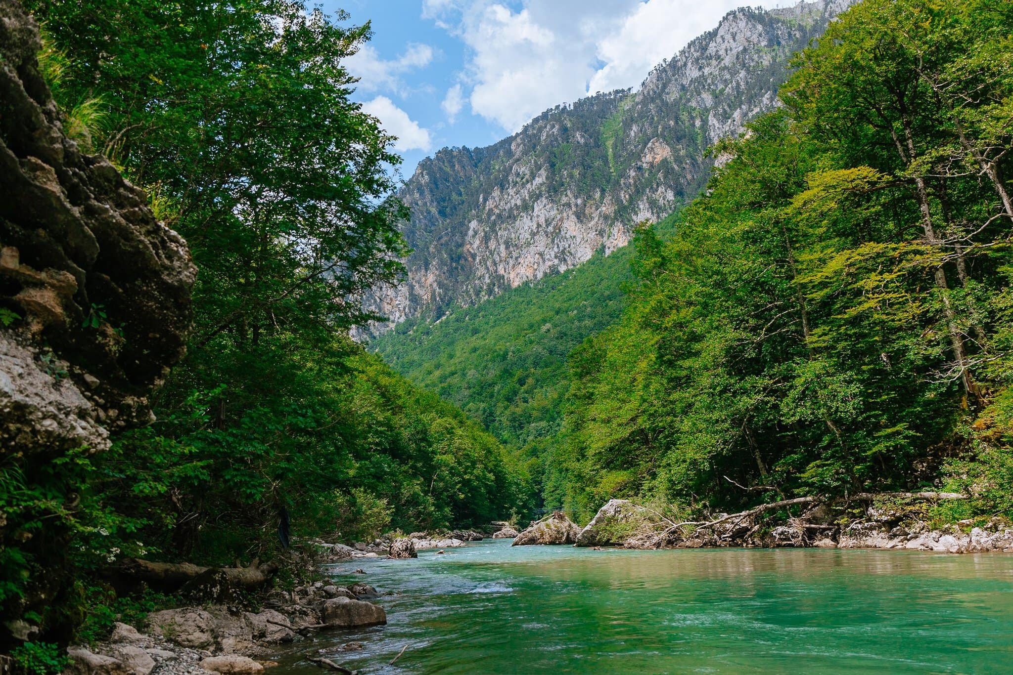
The Tara River Canyon cuts through the Dinaric Alps in northern Montenegro, plunging up to 1,300 meters deep in its most dramatic sections, making it the deepest canyon in Europe and, by some measurements, the second-deepest in the world after the Grand Canyon in the United States. Over roughly 78 kilometers, the emerald-green Tara River has carved this narrow, steep-walled gorge through limestone bedrock, creating a landscape of sheer cliffs, dense pine forest, and some of the cleanest river water remaining anywhere on the continent.
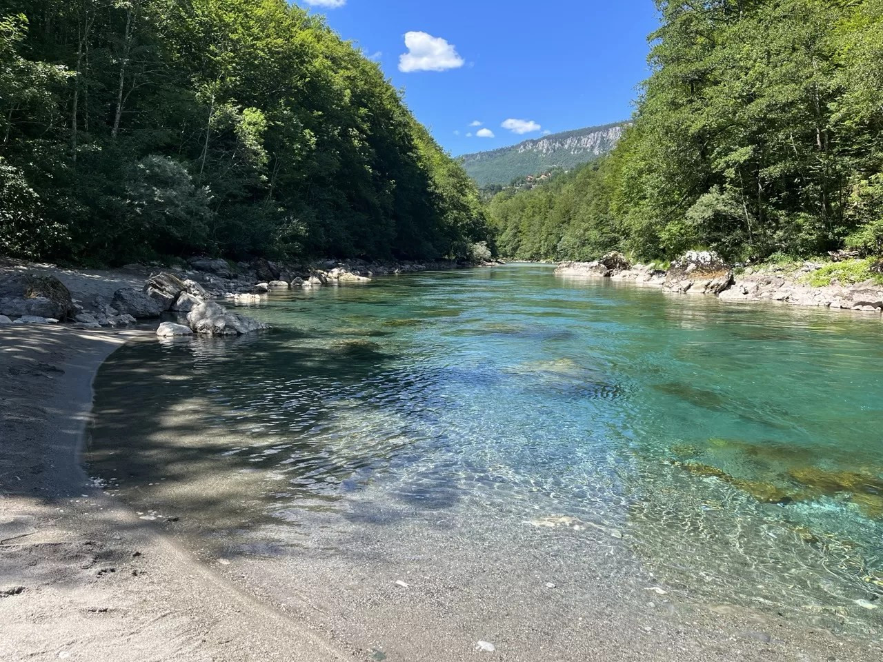
The canyon's remarkable water clarity comes from its almost entirely unpolluted mountain catchment and the river's largely undammed course through protected forest, conditions increasingly rare for a European river of this size and giving the Tara a reputation among rafters and ecologists alike as one of the last genuinely wild major waterways left in Europe.
Like other major canyons worldwide, the Tara Canyon formed through sustained fluvial erosion, the river slowly cutting downward through resistant limestone over an extended geological timeframe, a process aided by the region's karst geology, which is prone to dramatic, steep-sided erosion patterns rather than the wider, more gradual slopes seen in softer rock formations elsewhere. The canyon's depth relative to its relatively modest width is part of what makes it feel so visually dramatic compared to broader, more sprawling canyon systems.
Surrounding peaks in Durmitor National Park, through which much of the canyon runs, rise dramatically above the gorge, some exceeding 2,500 meters, creating an unusually stark vertical contrast between glacially sculpted alpine summits above and the river-carved gorge cutting through the mountains' base far below.
The Tara River Canyon runs largely within or alongside Durmitor National Park, established in 1952 and inscribed as a UNESCO World Heritage Site in 1980 both for its dramatic glacial and river-carved mountain scenery and for the exceptional biodiversity supported across its forests, alpine meadows, and glacial lakes. Durmitor's combination of jagged limestone peaks, eighteen glacial lakes locally called "mountain eyes," and the canyon itself gives the park an unusually varied landscape within a relatively compact protected area.
Old-growth forest within the park, including some of the last remaining primeval woodland in the Balkans, adds further ecological significance, with certain sections never having been commercially logged, preserving forest structure and biodiversity increasingly rare across much of the wider European continent.
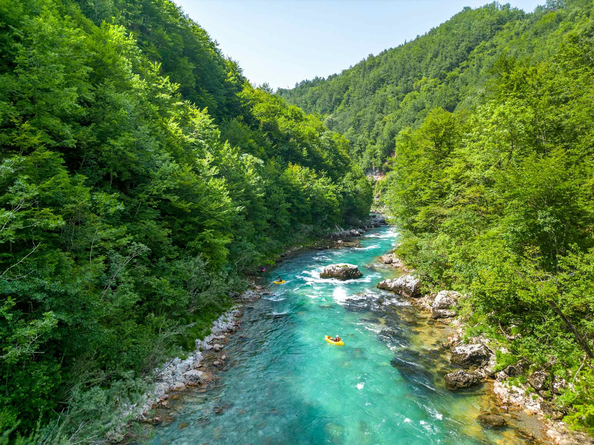
White-water rafting has become the Tara Canyon's signature visitor activity, with sections of Grade 3 and 4 rapids offering serious but manageable thrills for both first-time and experienced rafters, typically run as a multi-hour or, for the full canyon traverse, multi-day expedition with riverside camping. Peak rafting season follows spring snowmelt, when water levels run highest, gradually tapering through summer as flow decreases and the river becomes calmer, if less dramatic for rafting purposes.
Rafting operators, most based in the small town of Zabljak or nearby river-access points, have operated on the Tara for decades, and the activity has become central to the regional tourism economy in what remains one of Montenegro's more remote and historically underdeveloped mountain areas.
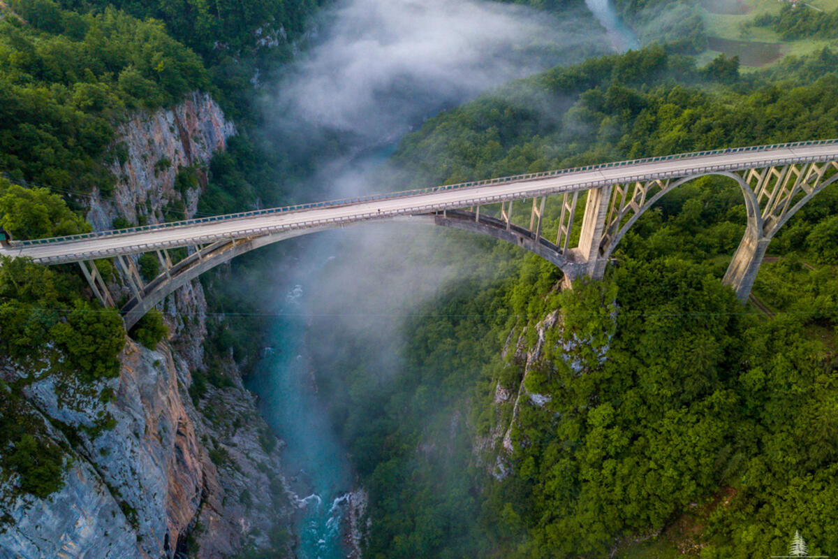
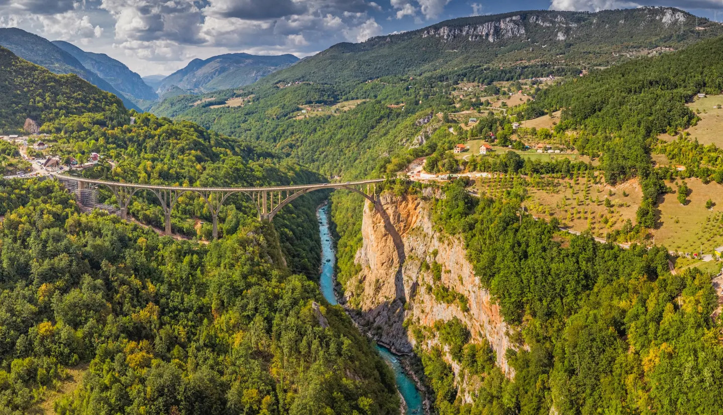
The Djurdjevica Tara Bridge, a striking five-arch concrete structure completed in 1940 spanning 172 meters above the canyon floor, holds particular historical significance: its chief engineer, Lazar Jaukovic, was executed by occupying forces during World War II after he sabotaged a section of his own bridge to slow a Nazi advance into Montenegro, a story now commemorated with a memorial plaque at the site. The bridge remains a major photography and viewing stop for canyon visitors and, more recently, has become a popular zip-lining and bungee jumping location as well.
This layered history, engineering achievement, wartime sacrifice, and now recreational tourism draw, gives the bridge a significance well beyond its practical role connecting the canyon's two rims for road traffic.
Plans for hydroelectric dam construction along the Tara River have periodically resurfaced since the Yugoslav era, most recently drawing significant public opposition in the 2010s from environmental groups and local communities concerned about flooding sections of the canyon and disrupting one of Europe's last major undammed rivers. Montenegro's government has faced ongoing pressure, both domestic and international, to permanently rule out damming given the river's UNESCO-linked protected status and its outsized importance to regional rafting tourism.
This tension between hydroelectric development potential and conservation, common to river systems worldwide, remains a live political issue in Montenegro, with the canyon's continued undammed status not entirely guaranteed for the long term despite its current protected designation.
Most visitors base themselves in or near Zabljak, Montenegro's highest-altitude town and the main gateway to both Durmitor National Park and the canyon's most accessible rafting put-in points, roughly a three to four-hour drive from the capital Podgorica. Viewpoints along the canyon rim, particularly near the Djurdjevica Tara Bridge, offer dramatic photography opportunities for visitors not planning to raft, while hiking trails through Durmitor's surrounding peaks provide additional vantage points over the gorge from above.
Because mountain weather here can shift quickly even in summer, layered clothing remains practical regardless of season, and rafting trips are generally suspended during periods of unusually high or dangerously low water flow depending on seasonal conditions.
The Tara River Canyon's combination of extraordinary depth, exceptional water clarity, and its status as one of the last major undammed rivers in Europe gives it ecological significance that extends well beyond its considerable scenic drama. As development and hydroelectric pressure continue affecting river systems across the continent, the Tara's continued protection increasingly stands as a test case for whether Europe can preserve at least a few of its remaining wild rivers intact.
The canyon and surrounding Durmitor forest support a range of wildlife increasingly scarce elsewhere in Europe, including brown bears, wolves, and golden eagles, populations that have benefited significantly from the region's low human density and largely intact forest cover compared to more heavily developed parts of the continent. Conservationists frequently cite the wider Tara-Durmitor corridor as one of the last functioning wilderness connections in the Balkans, allowing large mammal populations room to roam that has been lost across much of the rest of southeastern Europe.
This ecological intactness adds another layer to the ongoing dam debate, since flooding sections of the canyon for hydroelectric power would not only alter the river itself but potentially fragment habitat connectivity that currently allows these larger, wide-ranging species to persist at viable population levels within the region.
No reviews yet. Be the first to share your experience!
Share your experience and help other travelers